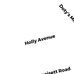
18 MATTAPOISETT ROAD
Owner Information
FERNANDES MARIO D
18 MATTAPOISETT ROAD
ACUSHNET, MA 02743


Property Details
18 MATTAPOISETT ROAD is classified as a Single Family Residential (Ranch).
The primary structure on this property was built in 2016. There are 2,476ft2 of built area within this property. There is 2,476ft2 of residential/living space within this property.
18 MATTAPOISETT ROAD is valued at $298,900. The land is valued at $138,100 and the structures are valued at $160,800.
The most recent deed for 18 MATTAPOISETT ROAD is recorded at the local registrar in Book 11408, Page 314. 18 MATTAPOISETT ROAD was last sold on Monday, June 29, 2015 for $90,725.
Assessment data from fiscal year 2021.
Flood Data
According to the FEMA National Flood Hazard Layer, this property does not appear to be in a flood zone. It may also be in an area not yet reviewed. Nonetheless, confirm this information prior to taking any action.
To view the flood hazards around this property, create a FEMA "Firmette" Map of the area around 18 MATTAPOISETT ROAD.
Broadband Internet Providers
| Provider | Type | Bandwidth (mbps) | |
|---|---|---|---|
| Viasat Inc | Satellite | 35 | 3 |
| GCI Communication Corp. | Satellite | 0 | 0 |
| HughesNet | Satellite | 25 | 3 |
| VSAT Systems, LLC. | Satellite | 2 | 1 |
| Comcast | Cable | 1000 | 35 |
| Verizon New England Inc. | DSL | 7 | 0 |
| T-Mobile | Fixed Wireless | 25 | 3 |
Broadband service provider data from December 2020.
Adjacent Properties
- REAR MATTAPOISETT ROAD
Developable Residential Land owned by VIEIRA REALTY TRUST - 0020 MATTAPOISETT ROAD
Single Family Residential owned by LOPES DONALD P TRUSTEE - 16 MATTAPOISETT ROAD
Single Family Residential owned by GRZELAK ZBIGNIEW - 0 HATHAWAY ROAD
Developable Residential Land owned by PIRES BRUNO & STACY